Turtle Bay, Manhattan, New York City
|
Getting Started
Index
NYC Neighborhoods
Manhattan
Brooklyn
Queens
Bronx
Staten Island
NYC Icons
Chrysler Building
Flatiron Building
Empire State Building
Safe NYC
NYPD
FDNY
NYC Weather
NYC Climate
NYC Weather Forecast
Winter Season
Spring Season
Summer Season
Fall Season
NYC History & Politics
New York City History
Tammany Hall and Politics
New York City Politicians
New York City Personalities
Culture of Gotham City
Culture of the city
Cultural diversity
City in popular culture
|
Turtle Bay is a neighborhood in New York City, on the east side of Midtown Manhattan. It extends between 42nd and 53rd Streets, and eastward from Lexington Avenue to the East River, across from Roosevelt Island. It was named after an actual bay that was filled in and is now the site of the United Nations Headquarters.
The origin of the name "Turtle Bay" is in some dispute. Some historians claim that it was due to the turtle-filled creek that emptied into the East River bay, while others have asserted that it was merely a corruption of the Dutch word "Deutal"-meaning a bent blade-that was used to describe the bay's shape. Turtle Bay was a valuable shelter from the often harsh weather of the East River, and it also became a thriving site for ship-building. By 1868, however, the bay had been entirely filled in by commercial overdevelopment, packed with slaughterhouses, cattle pens, and railroad piers.
The Turtle Bay neighborhood was originally a 40 acre (160,000 m²) grant given to two Englishmen by the Dutch colonial governor of New Amsterdam in 1639, and named "Turtle Bay Farm". After the street grid system was initiated in Manhattan, the hilly landscape of the Turtle Bay Farm was graded to create cross-streets and the land was subdivided for residential development.
An army enrollment office was established at Third Avenue and 46th Street, after the first Draft Act was passed during the American Civil War. On July 13, 1863, an angry mob burned the office to the ground and proceeded to riot through the surrounding neighborhood, destroying entire blocks. The New York Draft Riots continued for three days before army troops managed to contain the mob, which had burned and looted much of the city.
After the war's end, the formerly pastoral Turtle Bay neighborhood was developed with brownstones. With an infusion of poor immigrants in the later part of the 19th century, and the opening of the elevated train lines along Second and Third Avenues, the neighborhood went into decay with crumbling tenement buildings. Much of it was restored in the 1920s, and a large communal garden was established. The clearing of the slaughterhouses for the construction of the UN Headquarters in 1946 and the removal of the elevated trains opened the neighborhood up for high-rise office buildings and condominiums. In 1957, the Turtle Bay Association was formed by residents and property owners in hopes of guiding the development to maintain the neighborhood's quality of life. The Association's efforts have resulted in more park and landscaping development, creating the neighborhood's tree-lined and relatively quiet atmosphere.
Currently, the stalled UN Headquarters expansion plan, originally announced in 2000, is opposed by some Turtle Bay residents over concerns about the loss of Robert Moses Park to a new UN building.
|
New York City Search
Quick NYC
|
|
|
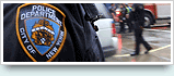 How safe is New York City?
 Contrary to popular belief, the City consistantly ranks in the top ten safest large cities in the United States. The NYPD is the largest municipal police force in the world and has it's own Movie/TV Unit. |
New York has a humid continental climate resulting from prevailing wind patterns that bring cool air from the interior of the North American continent. New York winters are typically cold with moderate snowfall.  New York Weather Forecast New York Weather Forecast |

New York's two key demographic features are its density and diversity. The New York City metropolitan area is home to the largest Jewish community outside Israel. It is also home to nearly a quarter of the nation's South Asians, and the largest African American community of any city in the country. Ethnic composition |

New York Newspapers
 
|