St. George, Staten Island, New York City
|
Getting Started
Index
NYC Neighborhoods
Manhattan
Brooklyn
Queens
Bronx
Staten Island
NYC Icons
Chrysler Building
Flatiron Building
Empire State Building
Safe NYC
NYPD
FDNY
NYC Weather
NYC Climate
NYC Weather Forecast
Winter Season
Spring Season
Summer Season
Fall Season
NYC History & Politics
New York City History
Tammany Hall and Politics
New York City Politicians
New York City Personalities
Culture of Gotham City
Culture of the city
Cultural diversity
City in popular culture
|
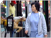
St. George is a neighborhood located at the northeastern tip of Staten Island in New York City, USA, at the location where the Kill Van Kull enters Upper New York Bay. It is the most densely developed neighborhood on Staten Island, and the location of the administrative center for the borough and for Richmond County. It has a large percentage of Irish Americans. It is also the site of the Staten Island terminal of the Staten Island Ferry, as well as the northern terminus of the Staten Island Railway. It is bordered on the south by the neighborhood of Tompkinsville and on the west by the neighborhood of New Brighton.
History
Fort Hill, one of the hills overlooking the harbor, was the location fortified by the British during the American Revolutionary War. The area was primarily rural up through the early 19th century. In the 1830s, the area facing the Kill Van Kull became a fashionable resort area, with the construction of several elegant hotels along St. Mark's Place across from the present site of Curtis High School (the oldest High School on Staten Island). The grandest and last of these hotels was the Hotel Castleton, built in 1889 and destroyed by fire in 1907.
Before the 1880s, the area was considered part of the New Brighton neighborhood until the consolidation of local ferry and rail service by Erastus Wiman, who reportedly renamed the area after George Law, a local investor who possessed land needed for the rail consolidation. Wiman, who fought to buy the land, had George Law made a Saint as favor for the land purchase. In the late 1880s, Wiman operated the Staten Island Amusement Company in the neighborhood, offering public athletic events, an illuminated fountain, and pageants.
In the early 20th century the neighborhood grew rapidly. Municipal ferry service to Manhattan began in 1905. The neighborhood was the scene of several elegant buildings by the architectural firm of Carrère and Hastings. These included a branch of the New York Public Library (1906), the present Borough Hall (1906), and the Richmond County Courthouse (1919).
In 1918, the Staten Island Institute of Arts and Sciences moved to its present location in the neighborhood. The United States Coast Guard operated a facility in the neighborhood until moving to Governors Island in 1967.
In 1924, the "Saint George" telephone exchange was established; this became "SAint George 7" when New York City's telephone service underwent a major upgrade six years later. This three-digit prefix, now identified by numbers - "727" - is the only one of the five exchanges which existed immediately prior to the aforementioned upgrade that is still in service on the island (in addition to St. George itself, this numeric designation is encountered in many other North Shore communities, as far away as Mariners Harbor to the west and South Beach and Grasmere to the south).
The neighborhood went into decline following the construction in 1964 of the Verrazano-Narrows Bridge, which shifted the center of development and commerce on Staten Island to the interior of the island.
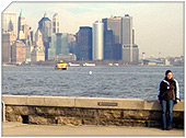
The community underwent a revival in the 1990s and property values have continued to rise since 2000. The residential Fort Hill neighborhood is home to many professionals who commute daily to Manhattan on the ferry, and includes many well-tended examples of victorian, tudor, and art deco architecture, in addition to one house modeled after a Spanish castle which has brought the neighborhood some recent media attention. Another popular upscale residential development, Bay Street Landing, abuts the bay between the ferry terminal and the head of Victory Boulevard. Redevelopment plans for the waterfront have led to the opening in 2001 of the Richmond County Bank Ballpark, the home of the Staten Island Yankees, a minor league farm club of the New York Yankees. The stadium offers dramatic views of the harbor and the Manhattan skyline.
|
New York City Search
Quick NYC
|
|
|
 How safe is New York City?
 Contrary to popular belief, the City consistantly ranks in the top ten safest large cities in the United States. The NYPD is the largest municipal police force in the world and has it's own Movie/TV Unit. |

New York has a humid continental climate resulting from prevailing wind patterns that bring cool air from the interior of the North American continent. New York winters are typically cold with moderate snowfall.  New York Weather Forecast New York Weather Forecast |

New York's two key demographic features are its density and diversity. The New York City metropolitan area is home to the largest Jewish community outside Israel. It is also home to nearly a quarter of the nation's South Asians, and the largest African American community of any city in the country. Ethnic composition |

New York Newspapers
 
|