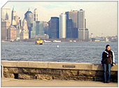
Port Richmond, Staten Island, New York City
|
Getting Started
Index
NYC Neighborhoods
Manhattan
Brooklyn
Queens
Bronx
Staten Island
NYC Icons
Chrysler Building
Flatiron Building
Empire State Building
Safe NYC
NYPD
FDNY
NYC Weather
NYC Climate
NYC Weather Forecast
Winter Season
Spring Season
Summer Season
Fall Season
NYC History & Politics
New York City History
Tammany Hall and Politics
New York City Politicians
New York City Personalities
Culture of Gotham City
Culture of the city
Cultural diversity
City in popular culture
|
Port Richmond is a neighborhood situated on the North Shore of Staten Island, one of the five boroughs of New York City, USA. It is along the waterfront of the Kill Van Kull, with the southern terminus of the Bayonne Bridge serving as the boundary between it and Mariners Harbor, the neighborhood which borders it on the west. Formerly an independent village, it is one oldest neighborhoods on the island. In the 19th century it was an important transportation and industrial center of the island, but this role has vanished nearly completely, leaving a largely blue collar residential area bypassed by the shift of development of the island to its interior after the 1960s. The formerly bustling commercial center along Richmond Avenue (now Port Richmond Avenue) has been largely abandoned, with the commercial activity shifting inland to Forest Avenue (or leaving the neighborhood altogether and relocating to the Staten Island Mall when the latter opened in the summer of 1973).
History
In 1700 the area was known as the "burial place" from a cemetery of the Dutch Reformed Church near the present location of Richmond Avenue along the waterfront. It later became a transfer point between ferries from New York City to New Brunswick, New Jersey. A ferry landing (called variously as including "Ryer's Landing", "Mercereau's Landing", and "Decker's Landing") was later constructed for a route linking Staten Island across the Kill Van Kull to Bergen Point (present-day Bayonne, New Jersey). The Bayonne Bridge was constructed in 1931 yet ferry service continued until 1962.
Cornelius Vanderbilt was born in the area in 1797. In 1836, former Vice President Aaron Burr died in Port Richmond at the St. James Hotel, a prominent hotel which once stood on Richmond Terrace until it was demolished.
In the early 19th century, the area was an overnight coach stop between New York City and Philadelphia. In 1836, a public park was built. In the middle 19th century, the area began to attract immigrants from Ireland and Germany. Among the industries established in the area was the only whale oil processing plant on Staten Island. It was later replaced by a linseed oil processing plant that operated until the 20th century. Other industries included lumber and coal yards, as a dye processing plant.
In 1866 the neighborhood was incorporated as Port Richmond. In the 1880s, the Staten Island Railway constructed a North Shore branch with a stop in the village on Richmond Avenue, which had become a main shopping area of the island. In the 1890s, an African-American church was established. At the beginning of the 20th century, it attracted large numbers of Italian, Polish, Norwegian, and Swedish immigrants. A public library was built with funds from Andrew Carnegie in 1902.
When telephone service was upgraded in New York City in December of 1930, a telephone exchange bearing the designation "POrt Richmond 7" was created, its territory including the neighborhood itself along with many other communities on the western and central North Shore plus the island's then-sparsely-populated, rural interior. This exchange was disconnected in 1948 when a "POrt Washington 7" exchange was established to serve the town by that name in Nassau County, on Long Island; the Port Richmond exchange's customers were then moved to exchanges that heretofore had been found to the east, such as "SAint George 7."
The neighborhood suffered a severe economic decline in the latter half of the 20th century, largely as a result of the shift of development and commercial activity to the center of the island, following the construction of the Verrazano-Narrows Bridge. The North Shore Branch of the Staten Island Railway that ran through the neighborhood connecting it to St. George was closed in 1953, leaving behind a dilapidated track and station along Richmond (now Port Richmond) Avenue (plans for reopening this line were studied at various times during the 1990s and early 2000s, but it is seen as unlikely that this will actually occur prior to the mid-2010s, if at all).
In recent years, Port Richmond has experienced considerable revitalization. Port Richmond Avenue is again thriving and the neighborhood population is growing. Mexican immigrants comprise a large portion of the growth. Mexican American businesses have driven the revitalization of Port Richmond Avenue.
In the 1990s, the population was approximately 75 % white (mostly concentrated in the community's interior), 12 % African-American, 10 % Latin American and 3 % Asian. The housing consists primarily of older one-family homes and small lots - and unlike many other North Shore neighborhoods, there are no public housing developments in Port Richmond.
|
New York City Search
Quick NYC
|
|
|
 How safe is New York City?
 Contrary to popular belief, the City consistantly ranks in the top ten safest large cities in the United States. The NYPD is the largest municipal police force in the world and has it's own Movie/TV Unit. |

New York has a humid continental climate resulting from prevailing wind patterns that bring cool air from the interior of the North American continent. New York winters are typically cold with moderate snowfall.  New York Weather Forecast New York Weather Forecast |

New York's two key demographic features are its density and diversity. The New York City metropolitan area is home to the largest Jewish community outside Israel. It is also home to nearly a quarter of the nation's South Asians, and the largest African American community of any city in the country. Ethnic composition |

New York Newspapers
 
|