Getting Started
Index
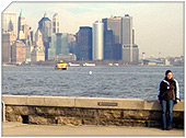
NYC Neighborhoods
Manhattan
Brooklyn
Queens
Bronx
Staten Island
NYC Icons
Chrysler Building
Flatiron Building
Empire State Building
Safe NYC
NYPD
FDNY
NYC Weather
NYC Climate
NYC Weather Forecast
Winter Season
Spring Season
Summer Season
Fall Season
NYC History & Politics
New York City History
Tammany Hall and Politics
New York City Politicians
New York City Personalities
Culture of Gotham City
Culture of the city
Cultural diversity
City in popular culture
|
Jamaica Bay is a lagoon that lies in the shadow of New York City's skyscrapers and is adjacent to one of the nation's busiest airports. The salt marshes of Jamaica Bay offer prime habitat for migratory birds and other wildlife. Most of the waters and marshes have been protected since 1972 as part of the Gateway National Recreation Area. Pollution, though much improved, is still a problem. The marshlands are also fast diminishing.
Jamaica Bay is located on the southwestern tip of Long Island in the boroughs of Brooklyn and Queens, New York City, and the town of Hempstead, New York. The bay connects with Lower New York Bay to the west through Rockaway Inlet and is the westernmost of the coastal lagoons on the south shore of Long Island. Maps of the city as late as 1910 identify the bay as Grassy Bay.
The location of Jamaica Bay combined with the rich food resources found there make it a regionally important fish, wildlife, and plant habitat complex. Jamaica Bay is located adjacent to the confluence of the New York Bight and New York Bay, and is at the turning point of the primarily east-west oriented coastline of New England and Long Island and the north-south oriented coastline of the mid-Atlantic coast. This geographic location acts to concentrate marine and estuarine species migrating between the New York Bight portion of the North Atlantic and the Hudson-Raritan Estuary. Shorebirds, raptors, waterfowl, landbirds, and various migratory insects are concentrated by the coastlines in both directions. These migratory species are further concentrated by the surrounding urban development into the remaining open space and open water of Jamaica Bay. Jamaica Bay and nearby Breezy Point support seasonal or year-round populations of 214 species of special emphasis and listed species, incorporating 48 species of fish and 120 species of birds, and including the following federally listed and state-listed species.
Area
Jamaica Bay is a saline to brackish, eutrophic (nutrient-rich) estuary covering about 101 km² (25,000 acres), with a mean depth of 4 meters (13 ft), a semidiurnal tidal range averaging 1.5 meters (5 ft), and a residence time of about 3 weeks. The bay communicates with Lower New York Bay and the Atlantic Ocean via Rockaway Inlet, a high current area that is one kilometre (0.63 mile) wide at its narrowest point, with an average depth of 7 meters (23 ft). Measurements taken during recent surveys in Jamaica Bay indicate average yearly ranges for temperature of 1 to 26 °C (34 to 79 °F), salinity of 20.5 to 26 parts per thousand, dissolved oxygen of 3.5 to 18.5 milligrams/liter, and pH of 6.8 to 9. Loadings of nutrients and organic matter into the bay from sewage treatment plants and runoff result in phytoplankton blooms and high suspended-solid concentrations which, in turn, result in turbid water and low bottom dissolved-oxygen concentrations. Jamaica Bay is in the middle of the New York metropolitan area, and the uplands around the bay, as well as much of the Rockaway barrier beach, are dominated by urban residential, commercial, and industrial development. The bay itself has been disturbed by dredging, filling, and development, including the construction of John F. Kennedy International Airport and, earlier, the historic (and now defunct) Floyd Bennett Field. About 49 of the original 65 km² (12,000 of the original 16,000 acres) of wetlands in the bay have been filled in, mostly around the perimeter of the bay. Extensive areas of the bay have been dredged for navigation channels and to provide fill for the airports and other construction projects.
The center of the bay is dominated by subtidal open water and extensive low-lying islands with areas of salt marsh, intertidal flats, and uplands important for colonial nesting waterbirds. The average mean low tide exposes 1.4 km² (350 acres) of mudflat, 3.8 km² (925 acres) of low salt marsh dominated by low marsh cordgrass (Spartina alterniflora), and 2.1 km² (526 acres) of high marsh dominated by high marsh cordgrass (Spartina patens). The extensive intertidal areas are rich in food resources, including a variety of benthic invertebrates and macroalgae dominated by sea lettuce (Ulva latuca). These rich food resources attract a variety of fish, shorebirds, and waterfowl. In addition, two freshwater impoundments were created on Rulers Bar Hassock in the Jamaica Bay National Wildlife Refuge; the smaller 0.2 km² (54-acre) freshwater West Pond is kept as open water, and the larger 0.5 km² (120 acre) slightly brackish East Pond is controlled to expose mudflats. Some of the islands in the bay have upland communities, including grasslands consisting of little bluestem (Schizachyrium scoparium), switchgrass (Panicum virgatum), and seaside goldenrod (Solidago sempivirens); scrub-shrub containing bayberry (Myrica pensylvanica), beach plum (Prunus maritima), sumac (Rhus spp.), and poison ivy (Toxidendron radicans); developing woodland consisting of hackberry (Celtis occidentalis), willow (Salix spp.), black cherry (Prunus serotina), and tree-of-heaven (Ailanthus altissima); and beachgrass (Ammophila breviligulata) dune. Species introduced in the Refuge to attract wildlife include autumn olive (Elaeagnus umbellata), Japanese black pine (Pinus thunbergii), and Japanese barberry (Berberis thunbergii).
|
New York City Search
Quick NYC
|


 New York Weather Forecast