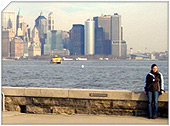
New Dorp Beach, Staten Island, New York City
|
Getting Started
Index
NYC Neighborhoods
Manhattan
Brooklyn
Queens
Bronx
Staten Island
NYC Icons
Chrysler Building
Flatiron Building
Empire State Building
Safe NYC
NYPD
FDNY
NYC Weather
NYC Climate
NYC Weather Forecast
Winter Season
Spring Season
Summer Season
Fall Season
NYC History & Politics
New York City History
Tammany Hall and Politics
New York City Politicians
New York City Personalities
Culture of Gotham City
Culture of the city
Cultural diversity
City in popular culture
|
New Dorp Beach is a beach at the foot of the town of New Dorp, along the southern shore of Staten Island, New York City.
It is between Midland Beach and Oakwood Beach.
History
The first recorded European settlement in the town of New Dorp occurred by the beach, in 1671, when Governor Edmund Andros patented the land to Obediah Holmes, an 86 acre (348,000 m²) parcel of land from the Governor's Lot. A small two room cottage was built along near the shore. This small, colonial home would later be owned by Nathaniel Britton, and be known as the Britton Cottage. This cottage would sit for over 200 years, as the area of New Dorp Beach developed around it, eventually finding itself sitting at the corner of New Dorp Lane and Cedar Grove Avenue.
After the Civil War, the area began to prosper as a resort, as campgrounds and seasonal bungalows began to develop along the gridded side streets along Cedar Grove Avenue. Along the waterfront, wooden piers and hotels popped up. The New Dorp Beach Hotel, formerly located along the beach, sat on a large lot which fronted both Cedar Grove Avenue and Marine Way, which once extended down to the water. Along the southern end, the Cedar Grove Beach Club grew, with a line of summer bungalows.
In 1879, the St. John's Guild acquired 14 acres (56,700 m²) of land along the shore of New Dorp Beach, and built a hospital, known as Seaside Hospital. This, along with a dock for their boat, would be owned by the St. John's Guild till 1951, when the hospital went up for sale. The hospital and its surrounding buildings would later be demolished.
Britton Cottage would be donated to the Staten Island Institute of Arts and Sciences by Nathaniel Britton, for the sake of preservation of colonial architecture. The house would be razed and rebuilt at the foot of Richmond Road, in Historic Richmondtown, in 1967. At that point, much of the old resort community and waterfront property on the beach side of Cedar Grove Avenue had been acquired by the city via eminent domain. The property was demolished to prepare for the Shore Front Drive, part of the master plan of Robert Moses. But by the 1960s, opposition to Moses' projects had forced the mayor to relieve Moses of his positions, and the city's fiscal crises helped to put a halt to the oncoming new highway, which was never built.
|
New York City Search
Quick NYC
|
|
|
 How safe is New York City?
 Contrary to popular belief, the City consistantly ranks in the top ten safest large cities in the United States. The NYPD is the largest municipal police force in the world and has it's own Movie/TV Unit. |

New York has a humid continental climate resulting from prevailing wind patterns that bring cool air from the interior of the North American continent. New York winters are typically cold with moderate snowfall.  New York Weather Forecast New York Weather Forecast |

New York's two key demographic features are its density and diversity. The New York City metropolitan area is home to the largest Jewish community outside Israel. It is also home to nearly a quarter of the nation's South Asians, and the largest African American community of any city in the country.  Ethnic composition Ethnic composition |

New York Newspapers
 
|


 New York Weather Forecast
 Ethnic composition


